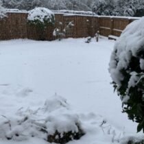
Northern England, (NW & Yorkshire) weather discussion January 2021
- This topic has 271 replies, 21 voices, and was last updated 4 years, 4 months ago by
Had Worse.
-
AuthorPosts
-
January 19, 2021 at 8:22 pm #231
 Kasim AwanKeymaster
Peak District forecast shows interest too with snow showers mentioned
This appears to be mostly for 150-200m+ on Thursday night, 1-5cm possible. Late Fri / Sat is more of an interest to low levels *if* the trough does not scupper convection.
January 19, 2021 at 9:23 pm #232 Kasim AwanKeymaster
ICON is @ upper end of predictions – patchy coverings to low levels potentially disruptive snow above 200m in the east..
Need to watch the other hi res very closely-
This reply was modified 4 years, 5 months ago by
 Kasim Awan.
Attachments:
You must be logged in to view attached files.January 19, 2021 at 9:23 pm #234 SouthYorksParticipant
Harmonie, Arpege, WRF-NMM, GFS Para all going for snow to some extent over our region in the early hours of Thursday morning as the cold air dig in.
Attachments:
You must be logged in to view attached files.January 19, 2021 at 9:54 pm #241 Kasim AwanKeymaster
Walsden EA river level forecast projects a breach of the all time record: https://flood-warning-information.service.gov.uk/station/8211?direction=u
Although positively the rainfall in the last 24 hours has been at 40% of the projections (50% being the median). Wednesday is very concerning though especially as the EA use UKMet data.-
This reply was modified 4 years, 5 months ago by
 Kasim Awan.
January 19, 2021 at 10:17 pm #243k8
ParticipantI have to travel to Stoke on Thursday morning what do you think Kas
January 19, 2021 at 10:19 pm #244 SouthYorksParticipant
Nothing so significant on the East side of the Pennines yet thankfully. Most rivers reporting 1-2m under flooding levels with just a couple of exceptions. Most notable, the Don around Doncaster, specifically Fishlake and Sprotborough, which have exceeded the minor flooding threshold. I think it would have been significantly different had the main rain band been further South today as had been predicted.
January 19, 2021 at 10:24 pm #245 Kasim AwanKeymaster
You should be ok in terms of road closures K8, this is not a classic snow event. Nontheless I expect (unless the GFSOP verifies) a good covering >200m in the East (potentially disruptive above 300m i.e. Buxton) with a spell of heavy sleet / wet snow giving localized coverings in the Cheshire plain perhaps as far west as St Helens for a short time.
January 19, 2021 at 11:37 pm #249 Kasim AwanKeymaster
Getting that upgrade vibe..
Night all.January 19, 2021 at 11:45 pm #250 Raul AlonsoParticipant
Meaning can you see any upgrades short term Kasim? That will b great news 😉
https://www.wunderground.com/dashboard/pws/ISALE43
January 19, 2021 at 11:48 pm #247Had Worse
ParticipantWalsden EA river level forecast projects a breach of the all time record: https://flood-warning-information.service.gov.uk/station/8211?direction=u
Although positively the rainfall in the last 24 hours has been at 40% of the projections (50% being the median). Wednesday is very concerning though especially as the EA use UKMet data.https://flood-warning-information.service.gov.uk/river-and-sea-levels?lng=-2.09936&lat=53.69100
Something you dont want to see.Welcome to Royston Vasey, You'll Never Leave.
January 19, 2021 at 11:52 pm #254 Kasim AwanKeymaster
> 18Z has upgraded the structure of tomorrow’s front, increasing interest for a stronger thermodynamic gradient (more optimal conditions for cooling)
My earlier assessment of localized heavy sleet / snow <150M & more substanial covering above in the east as being most likely still applies.
Speak tomorrow afternoon all
January 20, 2021 at 5:36 am #256Weather enthusiast
ParticipantThe GFS 0z ensembles have some ridiculous snow amounts around here (SW Manchester) for early hours tomorrow
11 ensembles have 10cm> including the control, Oldham have 17 such ensembles
January 20, 2021 at 7:28 am #257Withington, Manchester, 38m ASL
ParticipantI could be wrong but it looks as though the 00z runs have increased the potential for Irish Sea shower activity over the weekend. The convective window appears longer and the uppers certainly cold enough at least.
January 20, 2021 at 9:00 am #258 Ramp, Rochdale/Saddleworth border.Participant
Seriously considering booking tomorrow off work so I can have a late one tonight and i can’t be arsed trying to get to Littleborough at 05:30 in the morning.
The worry is I book it and it’s another let down.-
This reply was modified 4 years, 5 months ago by
 Ramp, Rochdale/Saddleworth border..
January 20, 2021 at 9:26 am #260 Yorkshire Snow Chaser Since 2004Participant
Thought I’d join Kasim after all your hard work on Netweather and so annoyed how they treated you on there.
Looking like tonight into Thursday early hours have upgraded slightly. Risk of a slight covering 100m+ but not sure it will last. Could be more surprises too.
Gfs Para trending deeper colder now too which gives me hope for East Yorkshire for February.
Attachments:
You must be logged in to view attached files.https://www.wunderground.com/dashboard/pws/IBARNS36/graph/2021-01-16/2021-01-16/daily
-
This reply was modified 4 years, 5 months ago by
-
AuthorPosts
- You must be logged in to reply to this topic.