Northern England, (NW & Yorkshire) weather discussion January 2021
- This topic has 271 replies, 21 voices, and was last updated 4 years, 4 months ago by
Had Worse.
-
AuthorPosts
-
January 24, 2021 at 5:11 pm #472
 SouthYorksParticipant
Potentially another snow event on Tuesday, but according to Arpege Thursday looks more interesting
Attachments:
You must be logged in to view attached files.January 24, 2021 at 7:12 pm #474 Raul AlonsoParticipant
What are your thoughts Kas on next week events for our part of the world? Should be looking at Tue, Thursday, Sat?
I know at this point is difficult guess but..can you share some light on what to look at next?https://www.wunderground.com/dashboard/pws/ISALE43
January 25, 2021 at 12:31 am #475Dkeane3
ParticipantIs Arpege the only model going for snow on Thursday? GFS looks quite warm…
January 25, 2021 at 12:57 am #476 Kasim AwanKeymaster
Showers heading towards Greater Manchester. Tuesday is marginal, tho interesting with some potential as is the weekend.
January 25, 2021 at 1:22 am #477 Kasim AwanKeymaster
I see that article from 2015 has been posted on netweather hahahaha, it’s actually now quite an embarassing article as I was 16/17 at the time. Have asked MEN to remove it.
January 25, 2021 at 7:58 am #478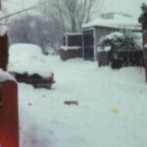 StelmerParticipant
Greetings!
Finally I get round to posting…. I’m furloughed for 3 weeks from 1st Feb, epic snows welcome during that time as I don’t have to go out in it XD! Meanwhile, this coming Thursday is the 26th anniversary of the Great Yorkshire Dump, a still unbeaten snow event here in Crossgates and a fair bit of Yorkshire.
Outdoor worker, winter forecasts are valued greatly.
January 25, 2021 at 8:51 am #479 SouthYorksParticipant
Arpege continues with a wintery outlook for Thursday, although at the moment it seems out in its own!
Attachments:
You must be logged in to view attached files.January 25, 2021 at 9:08 am #481 Winterof79ParticipantJanuary 25, 2021 at 2:12 pm #483
 Kasim AwanKeymaster
Snow tomorrow mainly 250m+ away from far North of England. Thursday-Sunday poses much interest.
January 25, 2021 at 2:35 pm #484 Kasim AwanKeymaster
Thanks Stelmer for your post. It would be nice if I could spend more time building up this site. The like button plugin has run into an error which is why it’s dissappeared but I still appreciate every post. Let’s see what Summer brings. I will have to move this site to a separate server soon so there will be some downtime, will let you know beforehand. Had put this site on the same server as where my High Res weather data is stored.
Ultimately a place for learning, and where I can vent snow forecasting information to a good community.-
This reply was modified 4 years, 4 months ago by
 Kasim Awan.
January 25, 2021 at 7:21 pm #486 SouthYorksParticipant
According to both ECM and Arpege 12z runs, large parts of our region could get a pasting on Thursday.
Attachments:
You must be logged in to view attached files.January 25, 2021 at 7:53 pm #489 Kasim AwanKeymaster
The potential with this front is in the slow movenent aspect associated with the pressure from height rises to our NNE. This could lead to serious snowfall accumulations given optimal positioning. Front too strong / high too weak and it will just be a transient front and back edge event.
January 25, 2021 at 7:57 pm #490 Kasim AwanKeymaster
The GFS shows this, strong front moving NE quickly pushing in a milder sector. The GFS/GEM are opposing the ECM/Arpege. Too close to call – middle ground favoured so slightly slower progression than gfs. This would allow for better development of front and back edge snowfalls. Note easterly winds, potential minor shadow (heights are low so this WONT BE A 100% STRONG SHADOW). The ECM/Arpege solution needs a watch for some on that the worst snowfall since the 80s.
January 25, 2021 at 8:21 pm #491Withington, Manchester, 38m ASL
ParticipantFascinating, cheers Kasim.
I’ll be honest as soon as I see easterly winds I often think the worst. Lots of interest anyway.
January 25, 2021 at 9:10 pm #492Had Worse
ParticipantGreetings to you all.
Thursdays outcome is very similar to last Wednesdays. Its either going to be very wet or very white, the latter probably a proper significant snow fall.
I’ve watched the bbc weather on News 24 and Thomaz Shaffernacher (however you spell it), showed white snowy areas from Liverpool NE. I was quite surprised by that, they are usually bullish on events.
Welcome to Royston Vasey, You'll Never Leave.
-
This reply was modified 4 years, 4 months ago by
-
AuthorPosts
- You must be logged in to reply to this topic.