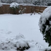
Northern England, (NW & Yorkshire) weather discussion January 2021
- This topic has 271 replies, 21 voices, and was last updated 4 years, 4 months ago by
Had Worse.
-
AuthorPosts
-
January 23, 2021 at 6:50 pm #451
 Raul AlonsoParticipant
Mmm do you think there is a chance at all for say all south Mcr for tomorrow front?
https://www.wunderground.com/dashboard/pws/ISALE43
January 23, 2021 at 7:35 pm #452 Kasim AwanKeymaster
Yes there is a chance espscy Crewe south.
January 23, 2021 at 7:38 pm #453 Raul AlonsoParticipant
Need bit more north.. Altrincham/Sale area 😉
-0.2c and 97% RH about 1cm snow still on grass and roofs 😉
https://www.wunderground.com/dashboard/pws/ISALE43
January 23, 2021 at 7:45 pm #454Dkeane3
ParticipantThanks Kasim, I’m thinking to follow the ECM and MetO as they have been consistent in their southern track
January 23, 2021 at 7:45 pm #455 Kasim AwanKeymaster
-1.8 with no melt apart from gritted roads
I’d say you could be the northern extent. Could be way south tho. 5050.
January 23, 2021 at 7:57 pm #456 Kasim AwanKeymaster
Thanks Kasim, I’m thinking to follow the ECM and MetO as they have been consistent in their southern track
Yes Keane but the wrf is not to be discounted given it’s performance recently.
January 23, 2021 at 8:00 pm #457 Kasim AwanKeymaster
Most likely zone of interest atm.
Attachments:
You must be logged in to view attached files.January 23, 2021 at 8:06 pm #459 Raul AlonsoParticipant
I got that RainToday as well. With the weather pro app u get all the Meteogrup apps 🙂 quite nice tbh
That line you draw needs to be thinner 😉
-
This reply was modified 4 years, 4 months ago by
 Raul Alonso.
https://www.wunderground.com/dashboard/pws/ISALE43
January 23, 2021 at 8:37 pm #461Withington, Manchester, 38m ASL
ParticipantFingers crossed for the WRF 😉
January 23, 2021 at 8:50 pm #462Had Worse
ParticipantHi Chaps,
Things seem to be simmering away at the moment. Certainly a very interesting winter (up here anyway).
I’m watching that precip with interest. I think its Northern extent will be somewhere around Bury GTR Manc.Thats my punt.
Welcome to Royston Vasey, You'll Never Leave.
January 23, 2021 at 8:56 pm #463 Kasim AwanKeymaster
I’d go with Liverpool / Manchester or North Cheshire as the northern limit. The instability is heading south through the front now as expected. So certainly further north than the Arpege etc not by a huge amount tho.
January 23, 2021 at 9:22 pm #464 Kasim AwanKeymaster
There is a pivotting stall tomorrow. Could occurr from south Cheshire to Birmingham. Need to keep an eye on the front speed on radar this is the most important factor, faster = further NE.
January 24, 2021 at 7:04 am #465 SouthYorksParticipant
Looks like todays snow will be mostly to the South of our region, with the pivot point being in the Midlands. Models have the northern extent in a line south Lincolnshire/Wash across to North Wales. Icon is slightly further North taking some snow into North Derbyshire/South Yorkshire/Manchester.
Attachments:
You must be logged in to view attached files.January 24, 2021 at 7:29 am #470Weather enthusiast
ParticipantLooks like todays snow will be mostly to the South of our region, with the pivot point being in the Midlands. Models have the northern extent in a line south Lincolnshire/Wash across to North Wales. Icon is slightly further North taking some snow into North Derbyshire/South Yorkshire/Manchester.
IMO, I would just look at the model that looks most like the current radar picture and go with that because some of them are clearly off. WRF is definitely too far south, it doesn’t have the precipitation reaching Llandudno at 8am and it is clearly further north of this now.
January 24, 2021 at 11:25 am #471 Kasim AwanKeymaster
Seems to be a lot of virga around now.
-
This reply was modified 4 years, 4 months ago by
-
AuthorPosts
- You must be logged in to reply to this topic.